
Become a Citizen Scientist!
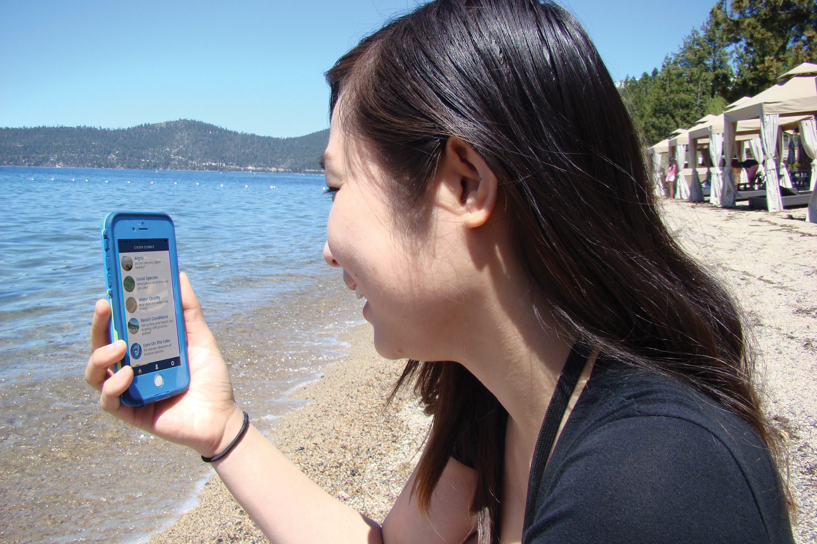
Citizens are being asked to submit their observations and photos of nearshore algae and water quality conditions using the Citizen Science Tahoe web app and the “Algae Watch” and “Water Quality” surveys. These submitted images and reports will be used by researchers to find hotspots in advance of monthly surveys and get a beach-goers view of the algae. Your observations and images are very helpful to this effort.
Citizen Science Tahoe Instructions
Step 1: Visit the CST home page at citizensciencetahoe.org and click on each survey that you wish to complete.
Step 2: Submit observations.
History
TERC originally launched the app this in August 2015, encouraging beach goers of all ages to tap in what they see at Lake Tahoe — data shared with scientists to better understand conditions around the lake. This app is currently in its fifth iteration and is now a web-based form. Citizen Science Tahoe 5 was developed by the UC Davis Tahoe Environmental Research Center (TERC) in collaboration with the Desert Research Institute (DRI) and League to Save Lake Tahoe (Keep Tahoe Blue).
This project was made possible in part by the Institute of Museum and Library Services (Award #MA-10-14-0533-14), the primary source of federal support for the nation's libraries and museums. The views, findings, conclusions or recommendations expressed in the Tahoe Citizen Science App do not necessarily represent those of the Institute of Museum and Library Services
Other Citizen Science Projects
Large-scale research projects often involve teams of scientists collaborating across states, countries or continents. More recently, with online platforms it’s not necessary to be a trained scientist to contribute to scientific research across the world. Citizen scientists act as volunteers monitoring the current state of their surrounding environment. Citizen Scientists for TERC make observations in the Tahoe Basin and contribute their data to the USA National Phenology Network and the Worldwide Water Monitoring Challenge.
Plant Phenology: TERC uses a phenology monitoring program in its native plant demonstration garden at the Tahoe City Field Station. Phenology is the study of specific plants’ seasonal changes or phases from year to year, such as growth, flowering, and fruiting. The phases of plants directly affect the rest of the ecosystem, especially insects and migratory birds. The timing of these changes has a relationship with weather and climate, and scientists expect that we will see many changes in plant phenology and the organisms dependent on these plants due to climate change. By tracking when these seasonal changes occur, we can quantify how much climate change is affecting the local ecosystem.
In TERC’s demonstration garden located in Tahoe City, there are currently four different plant species under observation: Bigleaf Lupine (Lupinus polyphyllus), Mountain Strawberry (Fragaria virginiana), Quaking Aspen (Populus tremuloides), and Ponderosa Pine (Pinus ponderosa). Visitors to the garden use data sheets for each plant to collect phenology observations. Each data sheet has instructions and photos to assist the observer. The data is then entered into Nature’s Notebook, a citizen science program under the USA National Phenology Network (https://www.usanpn.org/data). Nature’s Notebook has a database with phenology data from sites across the country, providing a broad look at plant phenology. Visitors can see how their observations fit into the big picture while learning about the biology of plants and the effects of climate change on the local ecology.
Stream Monitoring: Worldwide Water Monitoring Challenge (http://www.monitorwater.org/ReviewReports.aspx)is an international education and outreach program that engages citizens to conduct basic monitoring of their local water bodies. The primary goal of the World Water Monitoring Challenge is to educate and empower citizens in the protection of their water resources. Many people are unaware of the impact their behaviors have on water quality. Conducting simple monitoring tests teaches participants about some of the most common indicators of water health and encourages further participation in more formal citizen monitoring efforts.
The water quality of a stream can be determined in several ways. Biological, chemical, and physical factors can all impact the quality of water. Knowing the conditions of lakes and streams provides general information, such as whether the waters are safe to swim in, fish in, or use for drinking. With the assistance of our docents, visitors test the water quality of Polaris Creek and Lake Forest Creek near the Tahoe City Field Station. Learn about pH, temperature, turbidity, electrical conductivity, and dissolved oxygen, and how to test for these parameters. Dig deep and determine the role that benthic macroinvertebrates (small insects and worms living on the bottom of the creek) play in analyzing water quality. Our monitoring efforts are aimed at determining the condition of the entire watershed. This is because we have come to realize that land-based activities affect the waters that drain from the land, including those beneath the ground. The waters in the watershed are all connected, and we must protect all of them.