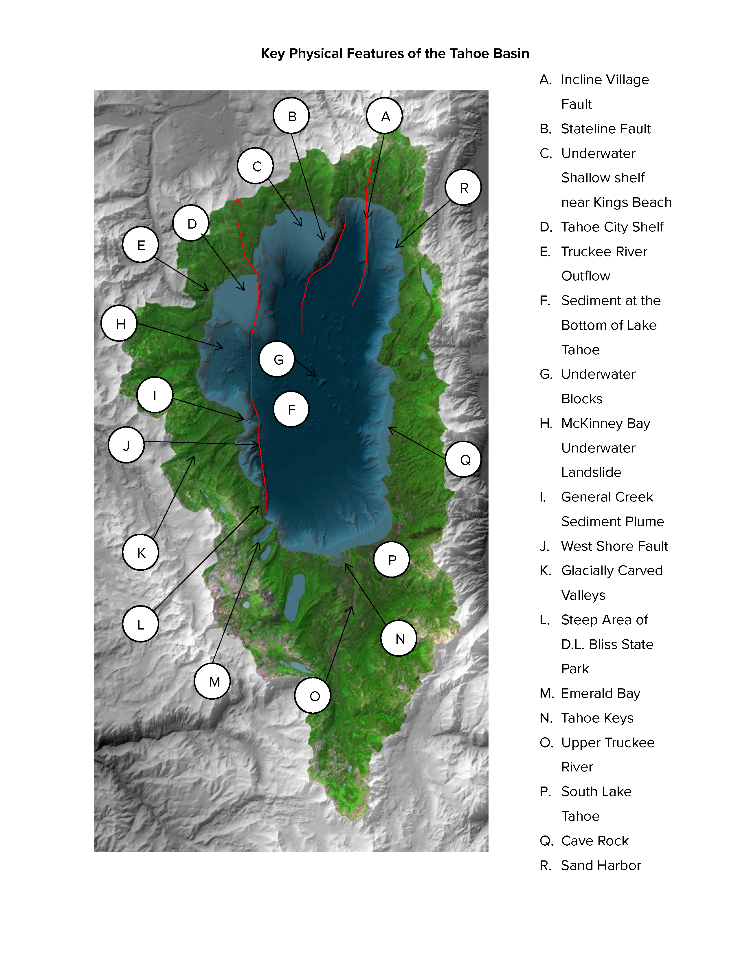
The Lake Tahoe Watershed Basin
This map is an artificially colored infrared IKONOS image. The IKONOS satellite sees objects as small as 3 feet! Taken in July 2002, we placed the image over a digital elevation model that represents the actual shape or topography of the ground. The bright green color represents the Tahoe Watershed has been artificially enhanced to highlight its features.
The watershed is the area of land that drains to a common water body. Any precipitation that falls within the colored area on the map will end up in Lake Tahoe, unless it evaporates or is taken up by plants first. One reason Lake Tahoe has remained so clear is the small size of its watershed in relation to the lake’s size.
Can you find the burn scar left from the July 2002 Gondola Fire near Heavenly Valley? Check out all the other features below and compare them to the map in the science center.